GTX - Geo Temporal eXplorer
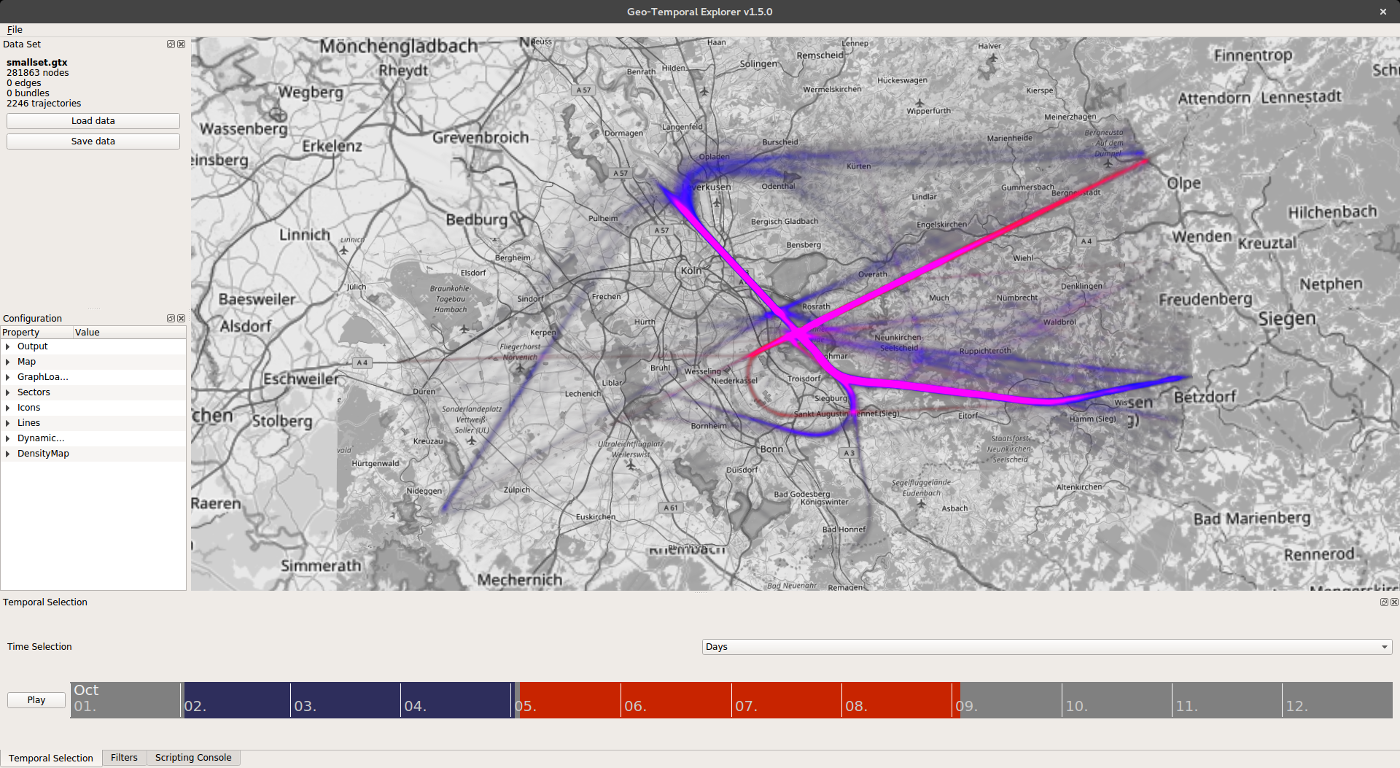
GTX is an interactive visualization software for dynamic geo-referenced data such as attributed 2D or 3D trajectories of moving objects or geo-referenced network data. Using C++ and modern OpenGL rendering for optimized performance, it allows for the visualization and interactive exploration of large spatio-temporal data sets in geographic contexts.
System Requirements
- Linux, Windows 7/8/10, or MacOS X (*)
- Dedicated graphics card required (>= OpenGL 3.3)
Virtual Geographic Environment
- 3D globe (osgEarth)
(*) Not available on OS X due to missing OpenGL 4.1 core compatibility of OSG and osgEarth - 2D projections (mercator, transverse mercator, 360° projection)
- Map layers (e.g., topographic map, OpenStreetMap)
Data Visualization
- Point-based geo-temporal data
- 2D/3D attributed trajectories
- 2D/3D geo-referenced networks
- Real-time density map generation
- Dynamic and interactive attribute mapping to
- Shape (lines, tubes, ribbons, spheres)
- Size or width
- Color
- Height
- Texturing and animation
- Interactive spatial and temporal filtering
- Attribute-based Filtering
Temporal Exploration
- Interactive Temporal Filtering
- Temporal focus+context and aggregation methods
- Space Time Cube
Interaction and Extensibility
- Interactive eploration and focus+context
- Scripting environment (JavaScript)
- C++ plugin system
Supported File Formats
- CSV files
- GraphML
- DOT